Some say it is a high adventure at cloud’s end,
Some say it is an adventure of few mad men,
Some say it is a pass only for mountaineer.
From my personal experience I can vouch for everything written above. Yes, it is Traill’s pass also known as Pindari Kanda. Altitude wise it is nothing compared to Himalayan giants we have in Uttarakhand, standing at 5312m.
If anyone starts to visit the history of Traill’s pass they will know how treacherous it was back then, and I will guide you through how treacherous it is now.
It is situated at the end of Pindari glacier and links Pindari valley to Milam valley (Lawan Gad). The pass was reached in 1830 by G.W. Traill, the first British Deputy Commissioner of Kumaon division. In 1926, it was crossed by Hugh Ruttledge. Since 1830 more than 86 teams have attempted but only 14 teams have succeeded to cross this silent beast. Peaks that can be seen from here are Nanda Devi (7816 m), Nanda Devi East (7434 m), Changuch (6322 m), Nanda Kot (6861 m), Nanda khat (6611 m) and Panwali Dwar (6663 m)
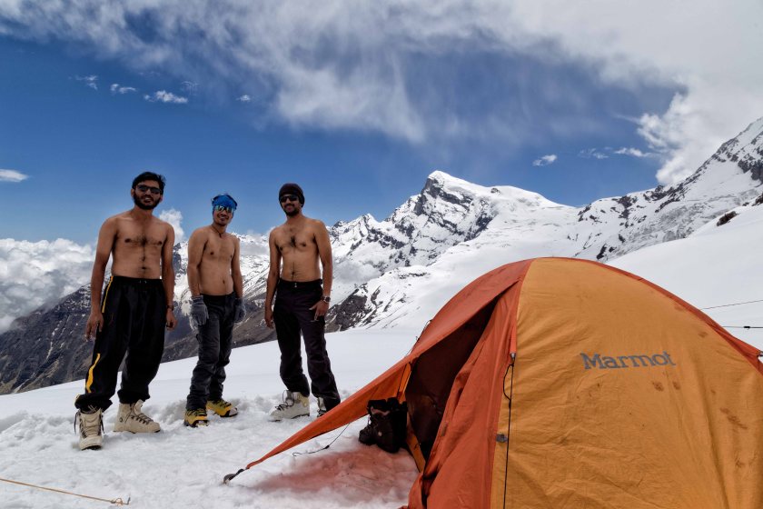
After spending long time planning, getting permit (from IMF) the scheduled date was 20th may. It had 5 members including me. Other members are Viswanath, Sathya, Manju and Vignesh. All of them have summited six thousanders before and have expertise in high altitude terrain.
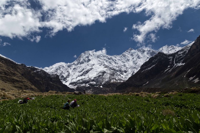
After reaching Kathgodam we met each other there and proceeded to Bagheswar, the temple city of Uttarakhand, situated in the confluence of Sarju and Gomti river. We had to divide the gear and sort out ration for upcoming days.
Next day our lead guide (Sovendra) and 4 high altitude porters joined us with the remaining climbing gears like snow bar, rock piton, harness, carabiners, rope etc. and we proceeded to the last motorable place called Kharkiya. The road is barely constructed and journey was painful. Midway through it started to pour heavily so we abandoned our plan to reach khati village which is a 5 km climb above. We can see snowfall happening to far bugyals / meadows.
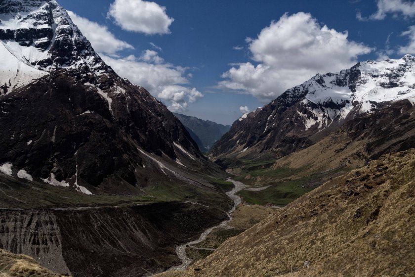
Next morning we decided to double time it to reach a place on the banks of Pindari river called Dwali. It was a moderate climb through well made trails but it was completely rocky so, it was tiring our legs quickly. I decided to move ahead of them and in the process I lost the actual trail and went into another one. Instead of going down the river I climbed back up top. When I actually found the mistake I had to descend through a rockfall zone. Tired and wet. I reached Dwali ahead of some of our members. The area became a rock fall zone due to the flash flood and other natural disasters happened in last 3-4 years.
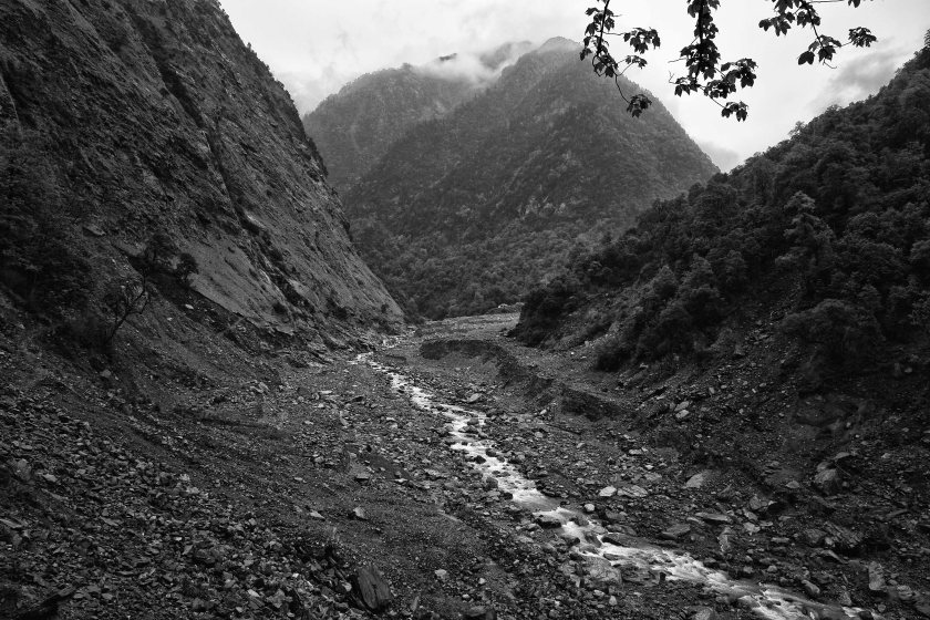 Broken river gorge became a rockfall zone towards Dwali
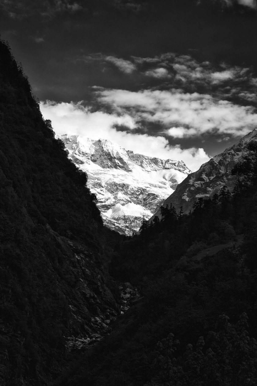
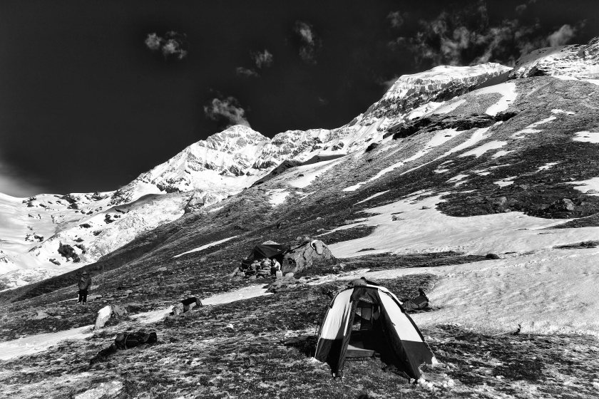
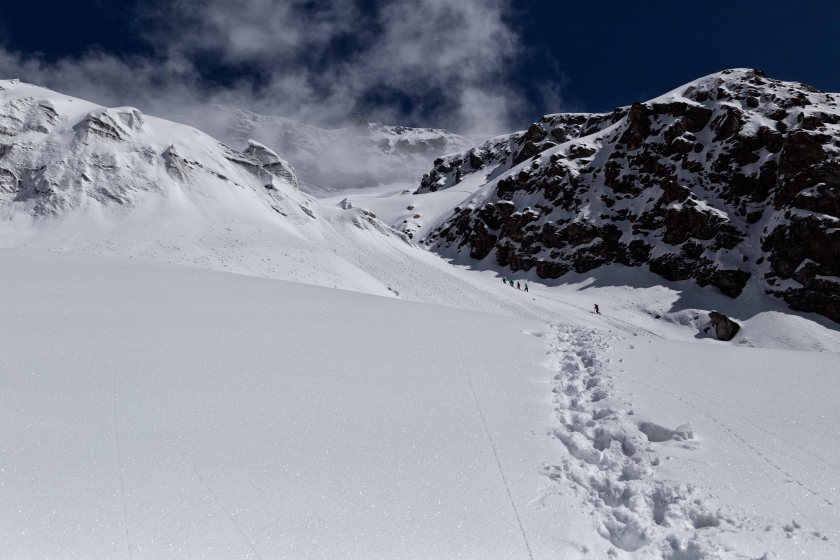
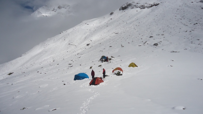
Again on the next day we decided to double time and reach Base camp (3500m). After crossing Dwali a steep climb is there for 6km and you reach an open gorge of Pindari river. The landscape changes drastically in couple of km. It is now harsh with scattered ice and you can see Mt. Changuch looming over the sky in front of you. A breathtaking view that reduces all the fatigue. We crossed the river and made a small climb to the base camp, a small flat area which allow pitching approximately 10 tents there. Crossing the river was a scary experience. We had to cross it over a log which has width of my Lowa boot. Nice view of Pindari glacier and gorge can be enjoyed from here.
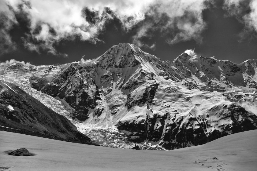
 Mt. Changuch (6322M) on the way to B.C.
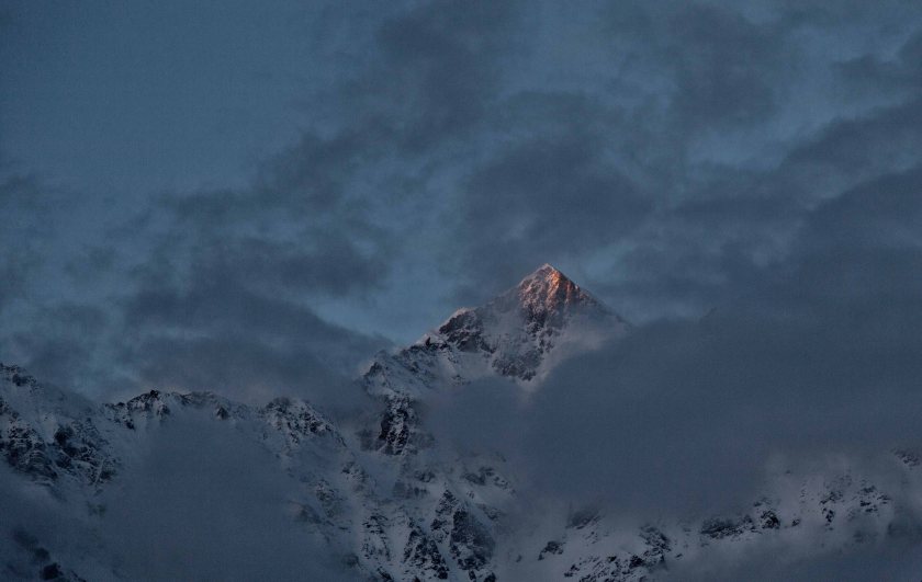 Last light of day reflects after storm lifted out on a unknown peak in Changuch Massif
 Pindari Gorge in distance
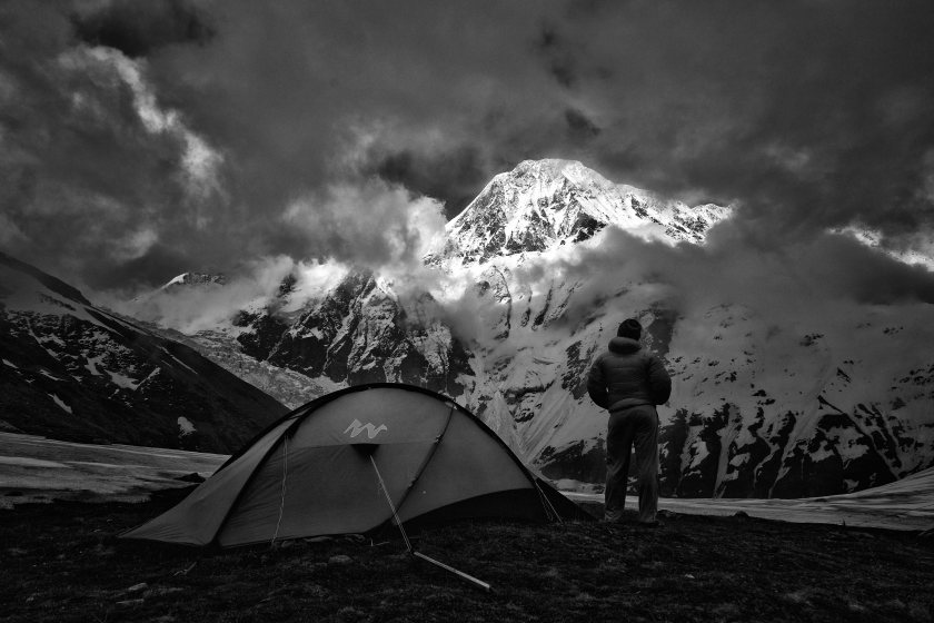
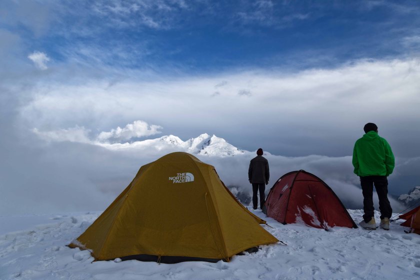
 On a good day B.C. view can blow you away
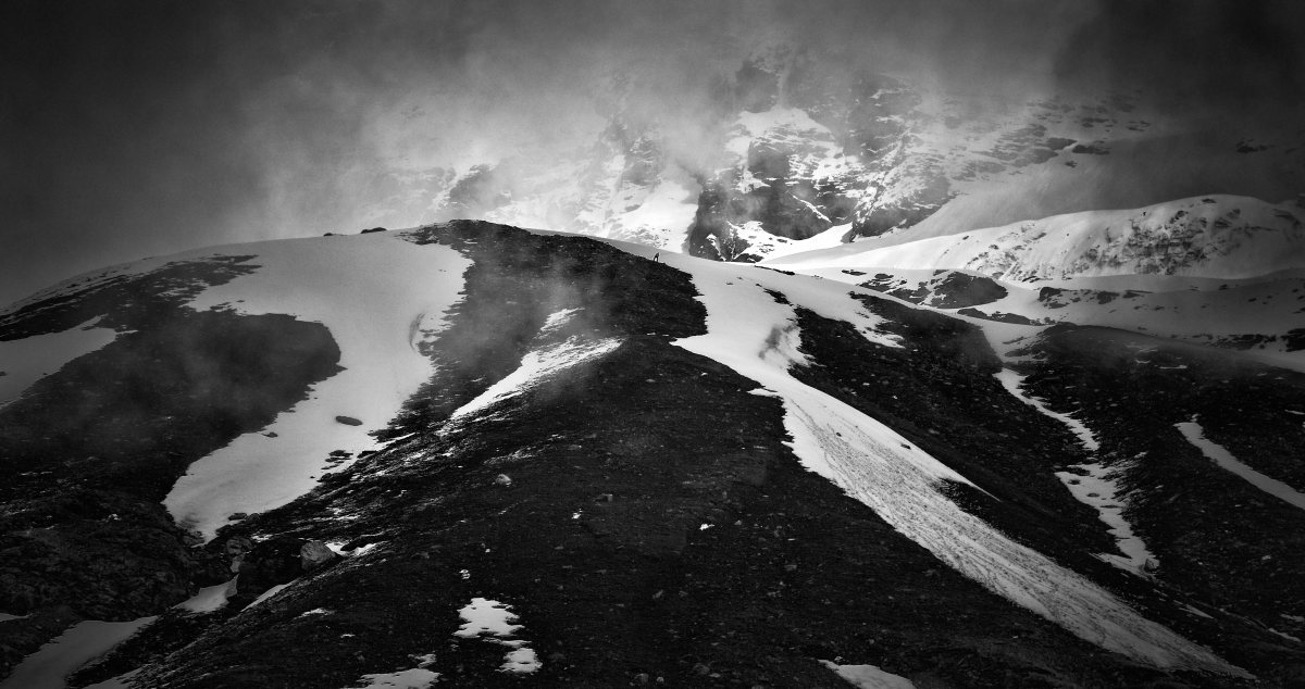
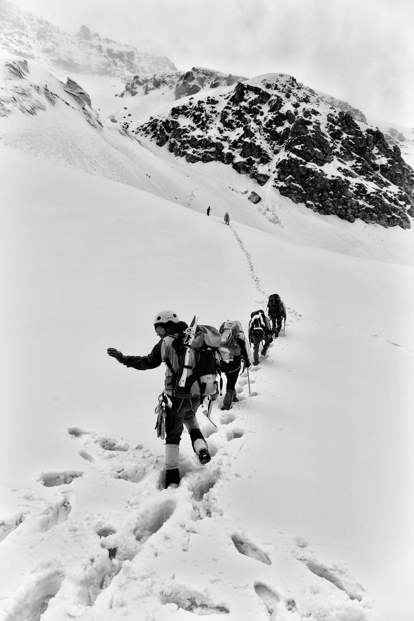
The real challenge started from the next morning. We went for the load ferry next morning. From here to advance base camp has an elevation difference of approximate 700m. It was Very steep climb up and mixed with rock ribs and rock faces. The climbing up was very tiring with load on the back and some time we had to use free climbing technique using all our limbs.After searching for some options about the best possible route to top, we traversed narrow ridge lines and made to top of first ridge. The first surprise hit us there. According to the previous data, there was a glacier which connected the two adjacent ridges. But in recent years that glacier receded back and made the area a scree filled rockfall zone and abrupt wild water streams. Storm clouds started to roll in and we were unsure about the route ahead so, we dumped the load there, anchored it securely against brutal wind and descended back in hailstorm.
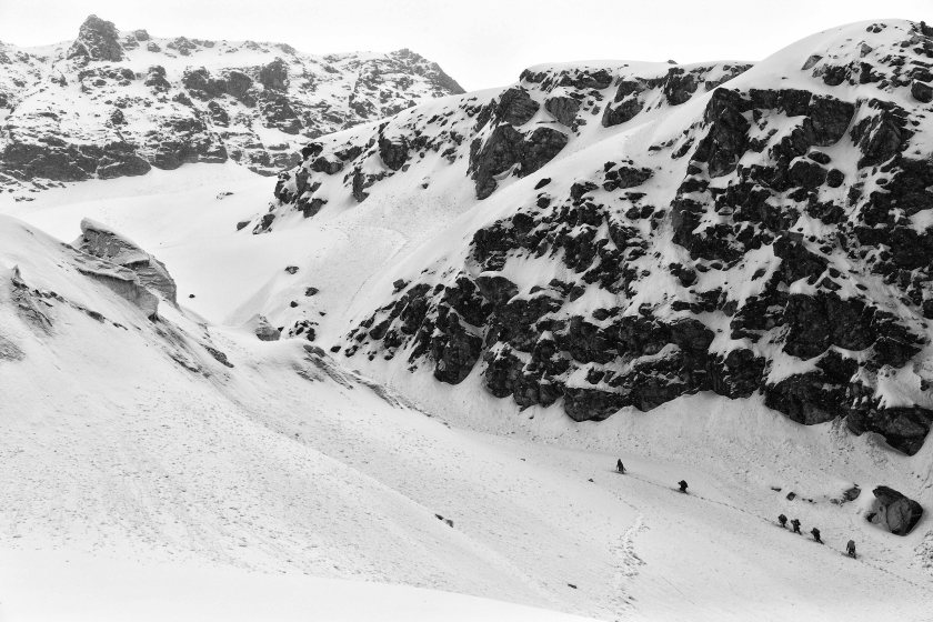
 Pindari river gorge seen from above on the way up during load ferry
 Sathya standing on the rock face which we had to negotiate with help from one another
Next morning one of our expedition member decided to go back down to civilisation as he was injured and not feeling well. After spending some time with him we again pressed to the top and this time with a different route which was more tiring but safer. Upon reaching the place where we dumped the load yesterday we decided to press on towards to C1. Suddenly a huge snow storm hit us as we started our decent through the rockfall zone towards glacier bed. I thought that climb to the next ridge line will be easier than the previous one. But astonishing me it was an also near vertical climb of approx. 300m plus that too in this snow storm. I looked back to the path which we came from and falling snow made it look that good that for a moment I forgot about the challenge ahead and thought I was in a winter paradise. It started to get pretty demanding as the visibility is getting lower and glasses are getting covered by snow. I pressed on without any word. It was a free climb using all limbs for support. Almost at the top of the ridge I slipped a little on a rock face as I lost balance but fortunately was able to self arrest myself from falling down from the cliff. Unfortunately that day was not over for me. Next was a narrow snow ridge line traverse. I was very much exhausted by this time and one miss step by me.
 Bottom most part of the rock spur. (P.C. – Manjunath B.S.)
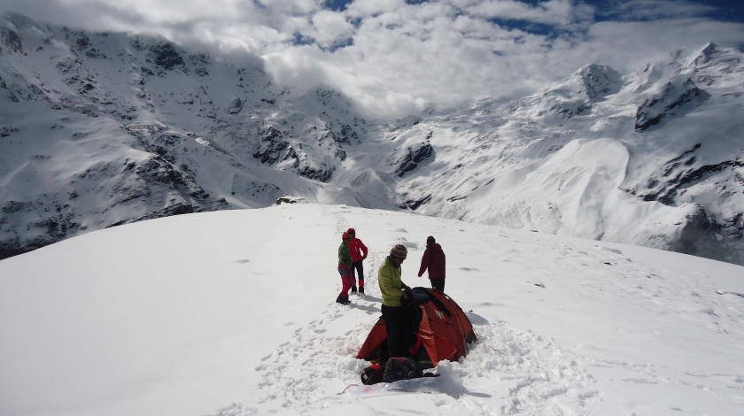
My entire life flashed in front of my eyes. I misjudged a step and slipped from the snow ridge line into the gully below. I was able to self arrest myself by the ice axe after at least approx. 10 ft slide. Sovendra helped me back up to the traverse line. When I crossed ridge then only I realized what a close call it was. Had it be 25-30 odd ft more, there was a vertical drop into the below rocky glacier bed, a drop into the abyss. We made to the ABC or better call it as C1 (as we crossed the glacier)
 After the storm lifted out on that day and Mt. Changuch towering us.
When they asked Mallory about Mt.Everest, he just said only one line “because it’s there”.For me this was very motivating to climb and there are breathtaking views as a reward which itches your heart for a lifetime. After the snow storm lifted out, C1 looked like a magical land. Series of known and unknown six thousanders looming in the skyline.
 Next Morning at C1 with Mt. Nandakhat and Mt. Panwali Dwar at the back
Next 2 days were spent by load ferrying from bottom ridge to upper intermediate camp and opening the route. Weather is miserable constantly. Till now weather has bombarded us with everything she has in her arsenal, battering hailstorm, snow storm, eye blinding whiteout. And constant sound of massive avalanches in the adjacent Changuch ice fall and West face kept reminding us about gravity of the situation.
 Mt. Changuch (6322 M) with her icefall below, This west face is technically very difficult and caused numerous deaths with only one successful attempt in 2011
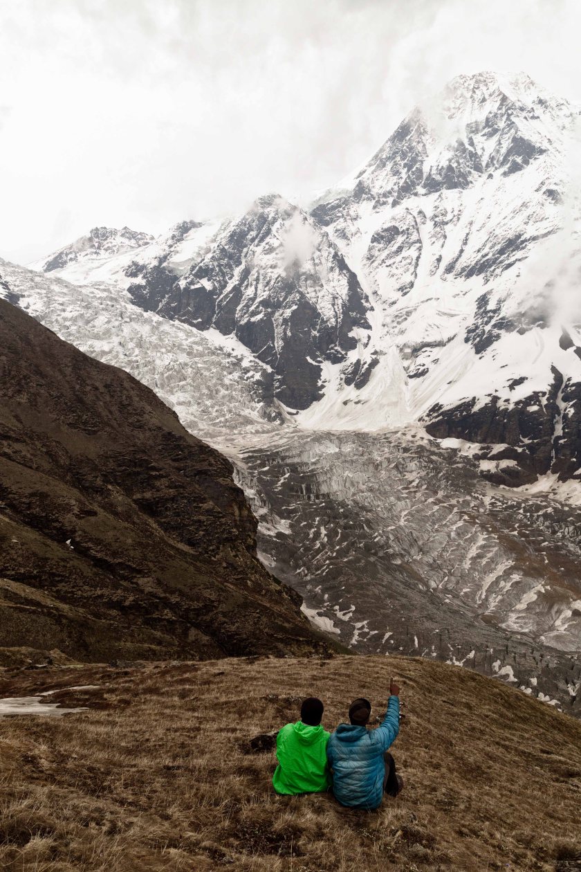 Sathya and Manju discussing about the ongoing avalanches in the Changuch massif.
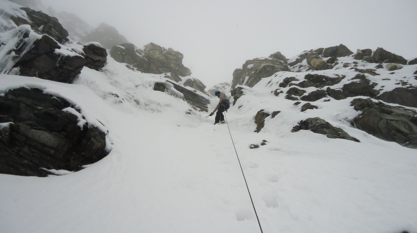
After two days, we started to push towards the C2. It’s very steep climb in rock faces and snow ridge lines. Within one hour weather turned her face towards us. Again a snow storm and whiteout encircled us. Because of constant snowfall for last couple of days it was more than my knee height. In this condition climbing up with heavy gear on back at 5000m is too much tiring.Every 10-15 m I had to stop to catch breath. Under heavy snowfall we reached the C2 and can see the massive wall just ahead of us, the biggest crux of the route.
 Sathya ahead of us in search of a route
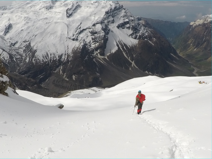
After weather cleared the peaks are now just a touch away from us. Practically you can summit Mount Baeljuri (approx 5800m) within 3-4 hrs by crossing a avalanche prone wide gully.
 (From left to right) Me, Sovendra and Manju posing for a photo. It was so cold that it felt like you are being hit by ice shards constantly. It was a stupid idea
 After the storm passed over at C2
Some of our team members decided to go ahead with rope fixing on the wall today itself. I did not join as I was not the most suitable person for the task and my right hand fingers were exposed to frost for substantial time during climb towards C1. When we are started sorting out technical gear, rope, bars and pitons a massive snow storm rolled in. But these iron man’s pushed ahead. I followed them for some distance and then they vanished from eye. I took refuge in my tent as fiery snowfall and wind battered me.
 Sovendra waves off at us before going up for rope fixing.
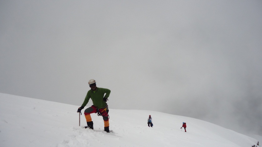
 They are at a distance

After waiting for some hours for Storm to lift out I was able to see one figure in the gully on the wall and my heart rejoiced. They have done it.
After all of them got back to the camp we heard the alarming news.
It is not possible to camp on top of wall as the wind force is that high it can kill us within hours by exposure, it can rip the tents and we need at least 7000 grade gears to survive that. It is not possible to navigate the crevasses on huge ice field and glacier ahead. Even with roping up in a team of five it is a daunting risk.
So, we decided to give it another try tomorrow. Tomorrow morning weather again engulfed us with whiteout after a brief sunshine. We went towards wall again and came back. After some discussion we abandoned out expedition attempts to go ahead as we can not wait anymore for stormy weather window to lift as our rations are diminishing quickly. It is time to go back to C1.
 Next morning during a very short weather window.
 Weather again went bad on the wall (P.C. – Manjunath B.S.)
 Towards the base of wall (P.C. – Manjunath B.S.)
 (P.C. – Manjunath B.S.)
After some hours we made to C1. Another snow storm rolled in. It snowed for more than 12 hours constantly. We were not able to open our tents as it went under snow. The world became uni colour next morning, only white is colour there and it increases chance of snow blindness.
 Next morning (P.C. – Manjunath B.S.)
 @C1 (P.C. – Manjunath B.S.)
It is time for the hard task again. Descend down the rock ribs again and in snowfall too. Ropes were fixed on the go again. We made it to the bottom of the rock rib by rappelling down. Then it was time to get down the next ridge after crossing the glacier bed. It was snow on top of wild grass on rock, a deadly combination. It gets stuck under your boot and gives you literally zero traction. I got down somehow after slipping and falling couple of times and reached BC. I felt relieved as well as heartbroken here.
 Sovendra takes rest during descent down the spur (P.C. – Manjunath B.S.)
Now we are homebound started towards to kharkiya and reached there 2 days. Tired, bruised, heartbroken, wet but increased thirst of crossing the pass in coming years.
As Stated by famous climber Ed Viesturs “Getting to the top is optional. Getting back down is mandatory”. One should always be very aware of the environment he/she is in, summit will always be there but you may not get another chance depending on the decisions you make now.
Below are some videos from the expedition
- Pindari log bridge crossing
- Load ferry preparation in snow storm
- Team climbing up for rope fixing
- Abhirup & Sathya Summarizing expedition
Below is the date Wise details
21st May : Bageshwar to Kharkiya
22nd May : Kharkiya to Dwali
23rd May : Dwali to Base Camp (30.26170N / 79.99222E / 3682 M)
24th May : Load ferry from Base Camp halfway to Camp 1 ( 30.27473N / 79.99676E / 4303M)
25th May : Base Camp to Camp 1 (30.28075N / 80.00437E / 4471 M)
26th May : Rest Day / Getting loads from halfway between base camp & camp 1 / Route opening from Camp1 to base of Wall ( 30.28786N / 80.00031E / 4900 M)
27th May : Rest Day / Load ferrying from Camp 1 to Camp 2 & route opening beyond Camp 2 to base of wall ( ~5000 M)
28th May : Camp 1 to Camp 2 (~4800M) and rope fixing/load ferry up the wall ( 30.29353N / 80.00035 E / 5367 M)
29th May : Stay in camp2 due to bad weather & retrieval of the load from top of the wall.
30th May : Ascent to the base of wall for Vishwa/Manju & descent to camp 1
31st May : Descent from Camp 1 to BaseCamp
1st June : Basecamp to Dwali
2nd June : Dwali to Kharkiya & drive to Bageshwar
Participants :
Members : Vignesh, Manjunath B S, Abhirup Bose, Vishwanath (Leader & Organiser) & Sathya (Dy. Leader)
Staff : Sovendra Panwar (Guide), Rajbir (HAP), Kritam (HAP), Rajesh ( HAP), Rawat ( HAP), Dev Singh (cook)
I want to extend my gratitude towards all the people who have climbed alongside me in those inhospitable conditions. A special thanks goes to Viswanath. He practically single handedly arranged all the things, from permits to technical gear to logistics. He is a freelance Trekker, climber with numerous achievements in multiple countries and also runs a adventure consultancy organisation named Summiters. A top notch professional in his field.
Viswanath’s details
About writer
Name : Abhirup Bose
Contact : 9748182679, Email : fotoflock.abhirup@rediffmail.com
And this is me

